Ibama already has had more than 100 drones to monitor illegal deforetation.
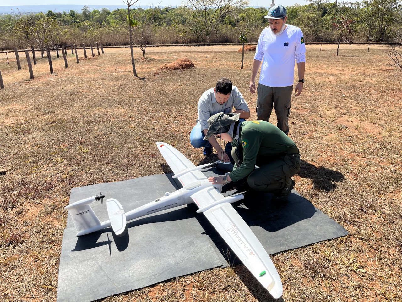
These are all multicopter drone, which are suitable for observing a wide aerial view and acquiring detailed ground data of a small area, but cannot fly for long periods due to their battery life. The National Center for Environmental Monitoring and Information - Cenima, which coordinates this project, is responsible for sending deforestation detection data by satellite to the inspection department. In order to improve the accuracy of these data, it will be necessary to verify it using detailed ground data from a large area. However, the project has had difficulty acquiring data of large areas by ground survey so far. In addition, some field validation has been carried out using Ibama helicopters, but it is difficult to use the helicopters regularly because it’s mainly used for enforcement purposes. So, the project has acquired the eVTOL (electric vertical take-off landing vehicle) drone, which has more flight range than a multicopter drone and can cover a large area. eVTOL drones fly like an airplane, but they can take off and land vertically, so they don’t need a runway to do so. They also allow you to fly over a wider area. As the operation of this drone is different from that of a multicopter drone, a training course was held on August 21-23 to learn how to fly it. The seven staff from Ibama took part in the training and learned how to organize the flight, assembly, piloting and even maintenance of the drone. From now on, an operating manual for the drone and flight training will be organized for use in field survey before the start of the rainy season in the Amazon. In addition, training and a manual for processing the data from the images obtained by the drone will be developed.